Preço do imóvel
Sob consulta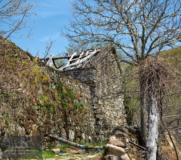
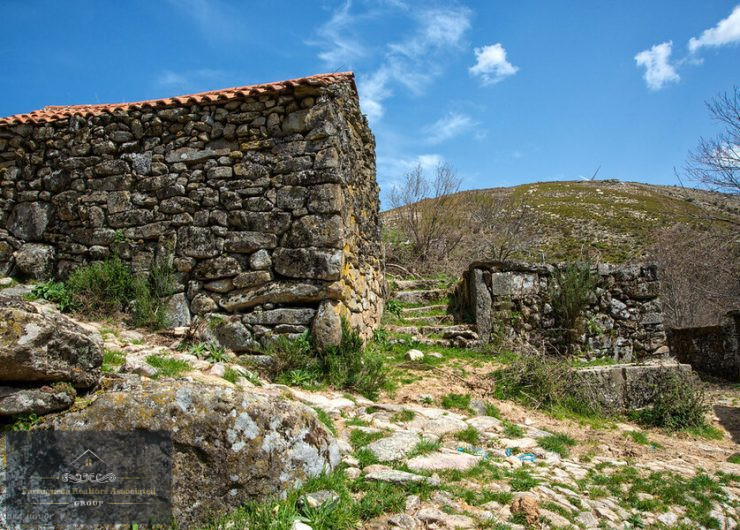
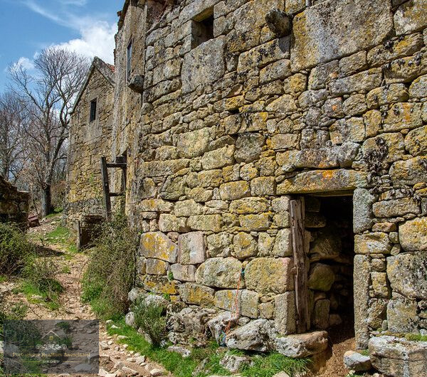
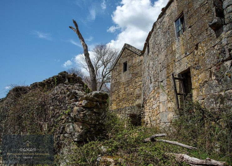
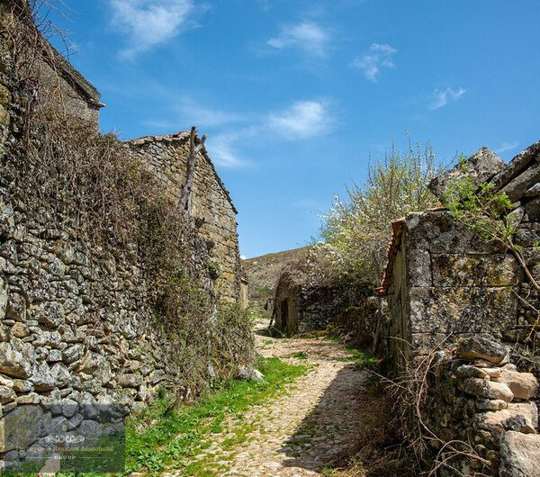
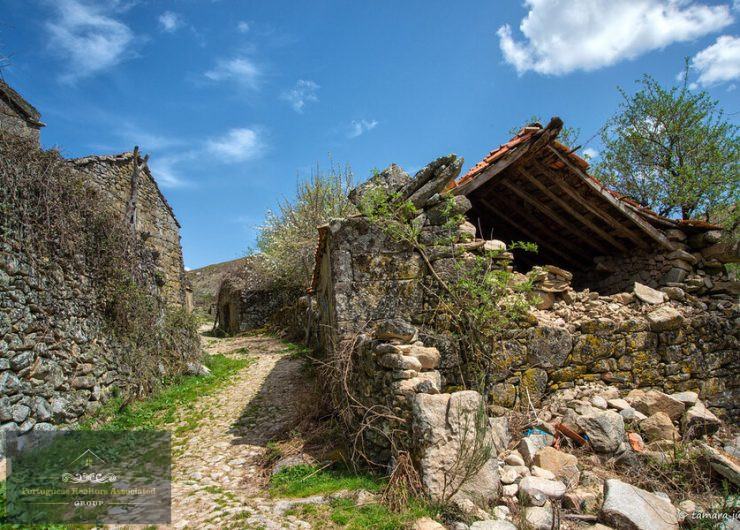
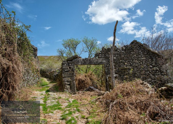
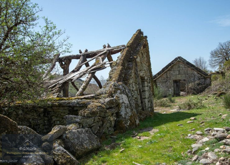
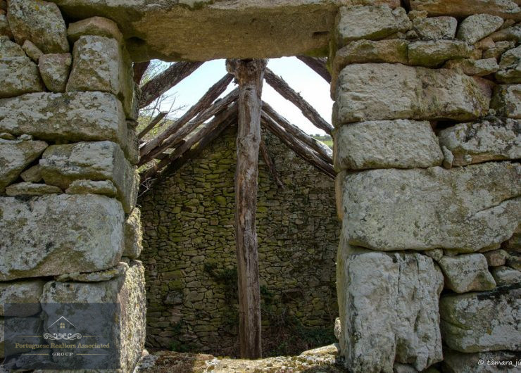
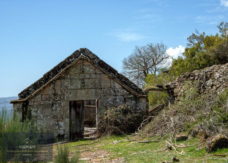
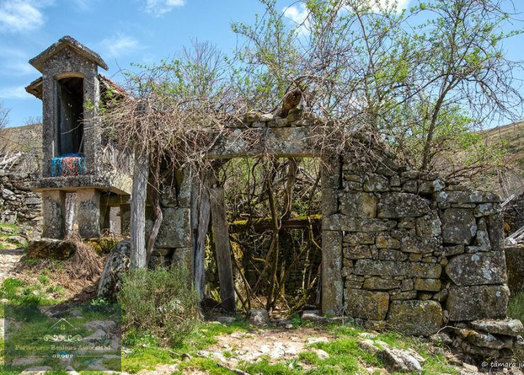
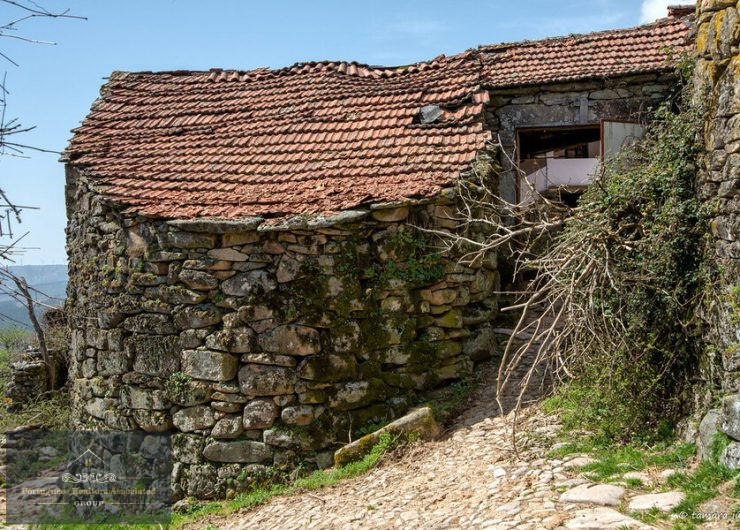
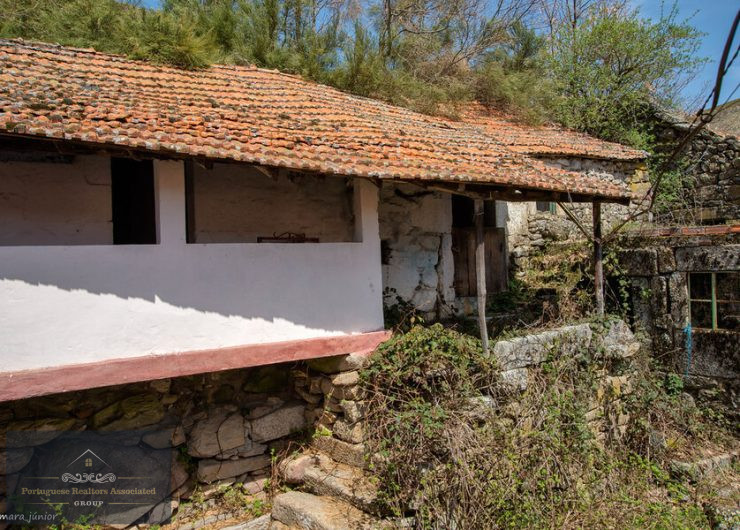
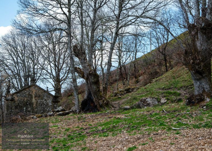

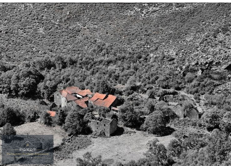
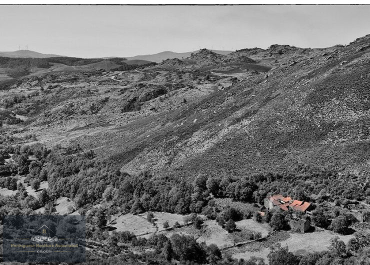
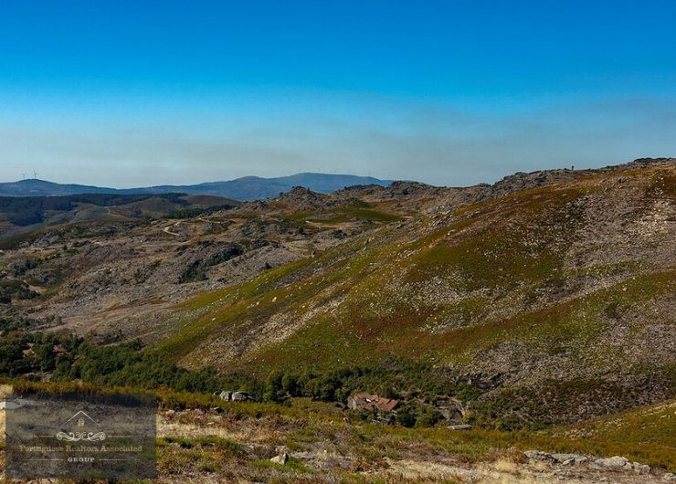
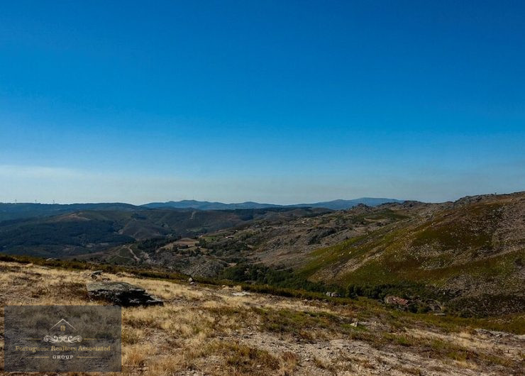
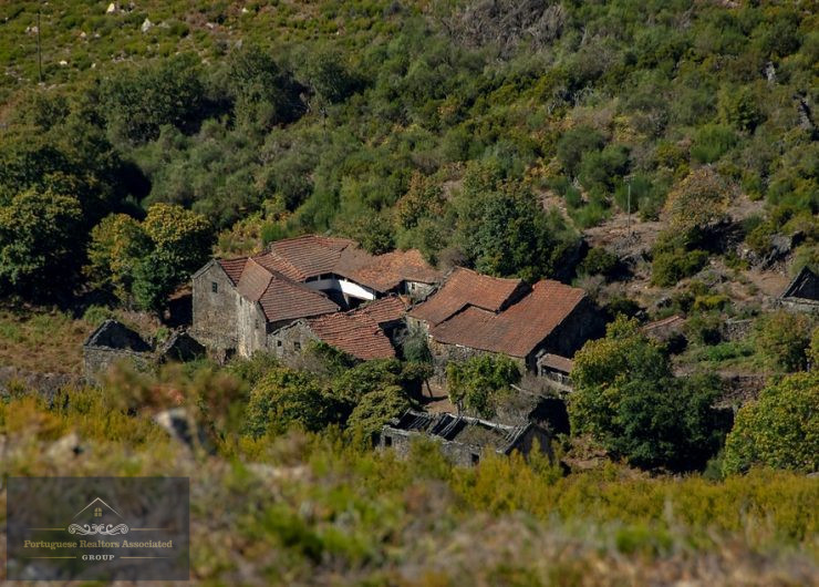
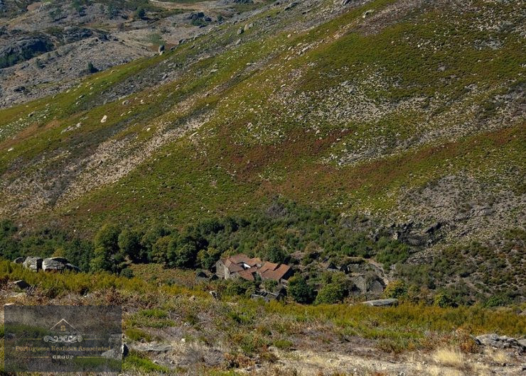
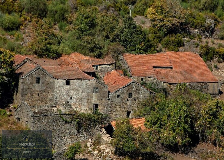
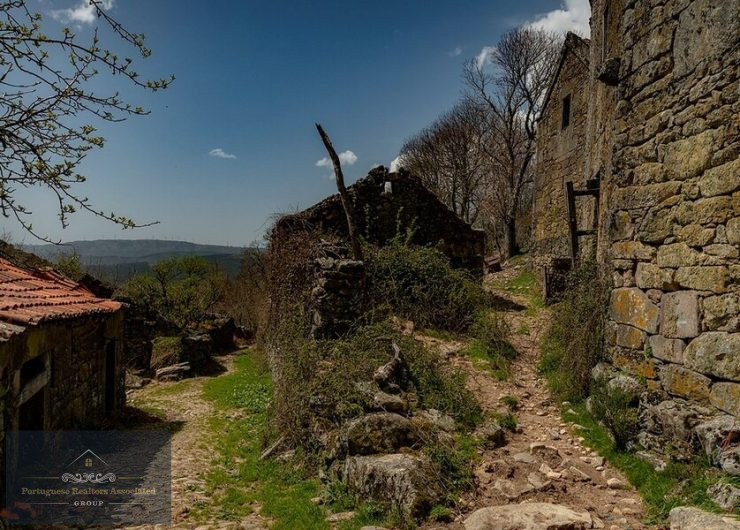
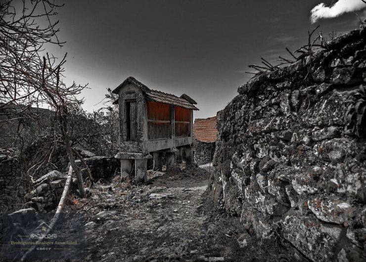
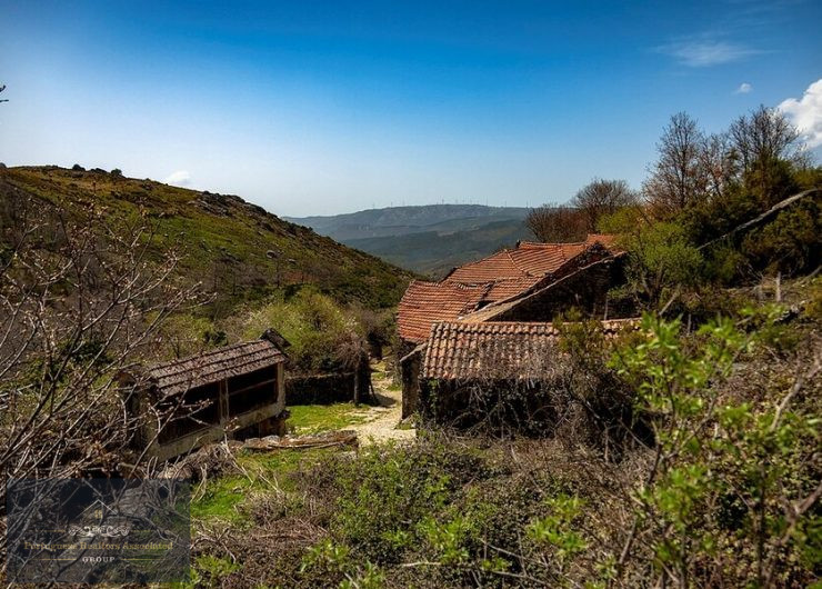
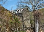
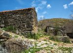
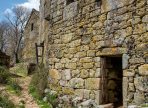
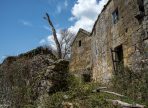
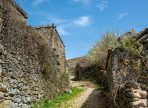
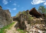
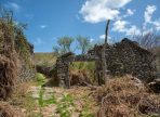
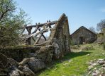
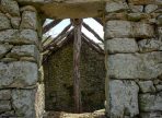
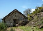
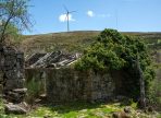
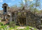
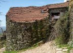
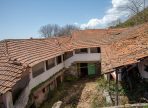
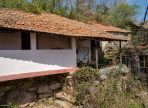
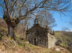
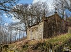
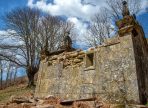
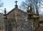
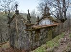
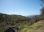

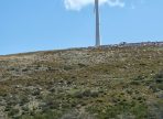
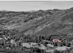
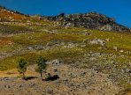
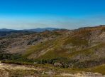
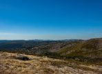
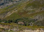
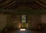
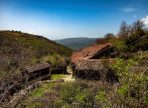
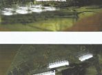


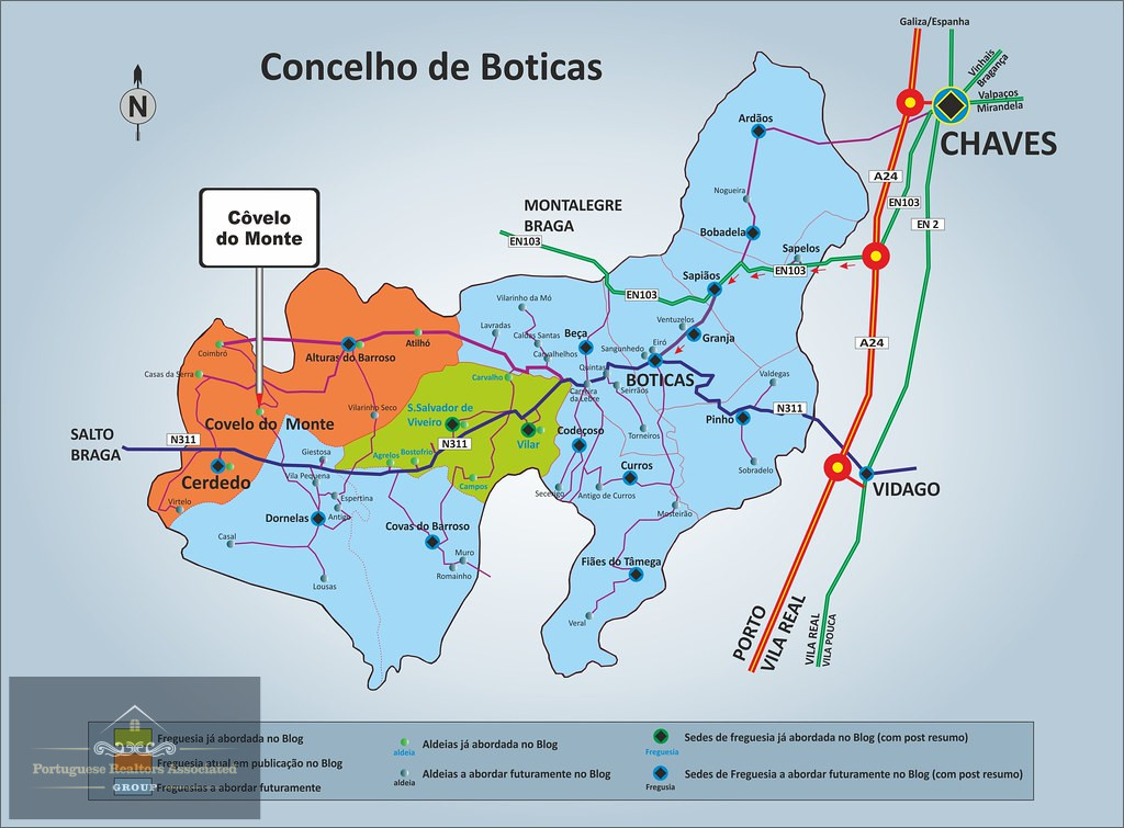
Covelo do Monte, a historic village abandoned since 1974, is located in the heart of the Serra do Barroso, between the municipalities of Montalegre and Boticas.
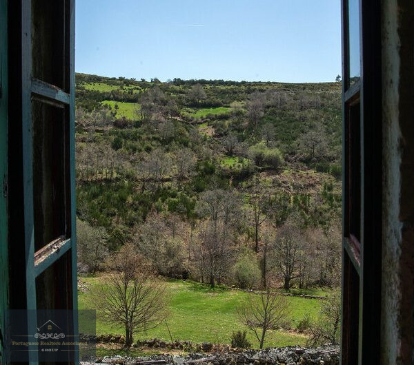
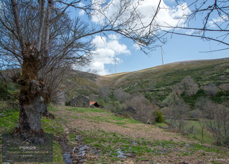
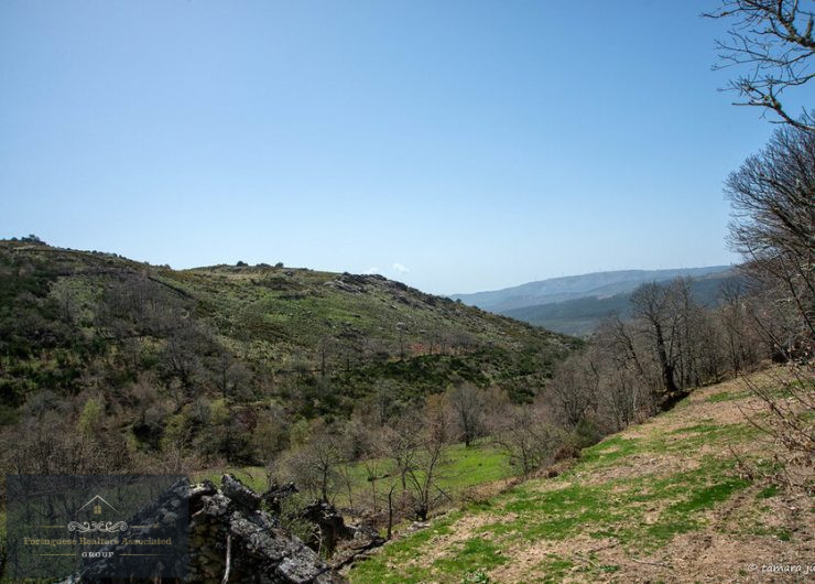
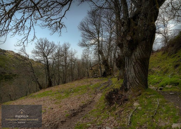
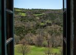
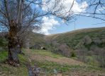
An authentic rural treasure, surrounded by breathtaking scenery and set in one of Portugal’s most unspoilt territories, next to the Peneda-Gerês National Park.
With a Municipal Master Plan (PDM) approved for 31,800 m², Covelo do Monte has extraordinary potential for sustainable tourism, organic farming and cultural heritage projects.
This is a unique opportunity for visionary investors who want to turn this village into a destination of reference.
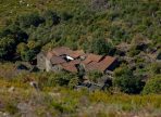
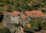
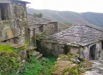
PROPERTY CHARACTERISTICS:
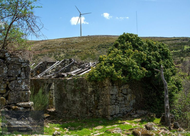
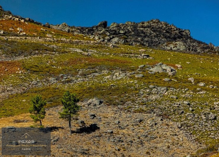
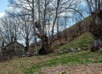
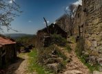
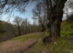
- 66 hectares of agricultural and forestry land – Ideal spaces for organic farming, agroforestry and sustainable livestock farming.
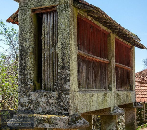
- 3.18 hectares of building area – Allows for the rehabilitation of existing buildings and new projects in line with the rural identity.
- Millenary chestnut grove – Potential for chestnut production, ecotourism activities and environmental valorisation.
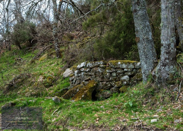
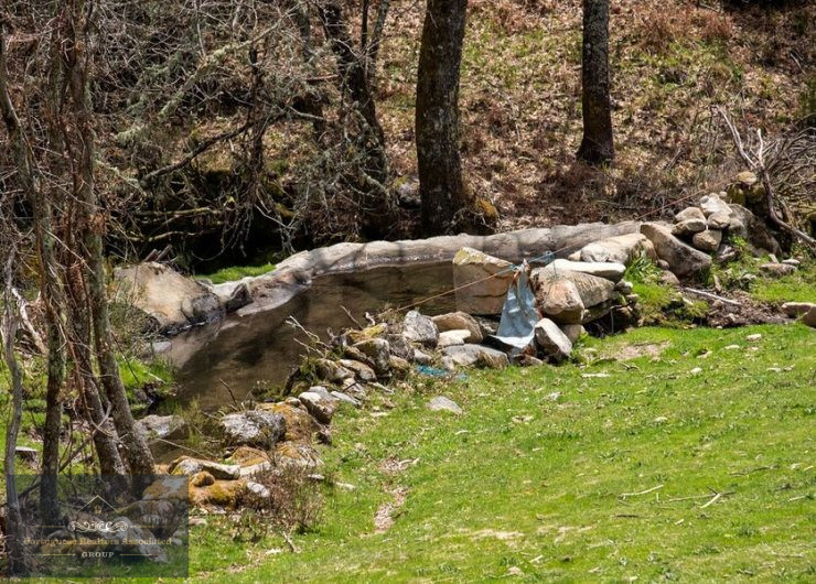
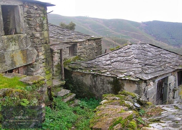
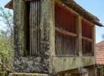
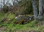
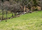
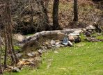
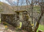
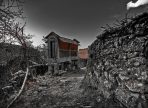
- Roman watermills and ovens – Historical heritage of great tourist and educational interest.
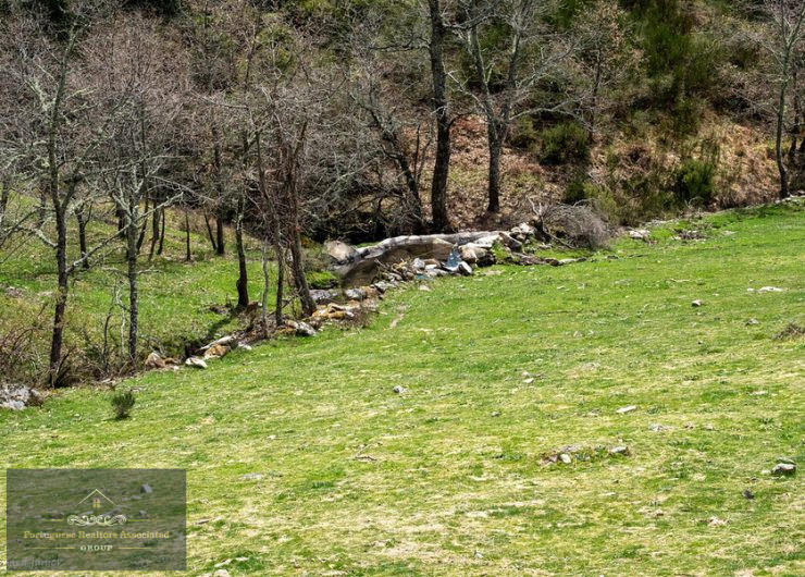
- Natural springs, water mines and waterfalls – Essential natural resources for water sustainability and environmental attraction.
- Celtic/Roman roads and paths – Ancient infrastructures ideal for historical and tourist routes.
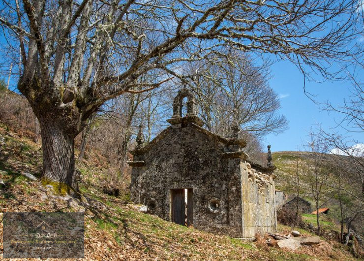
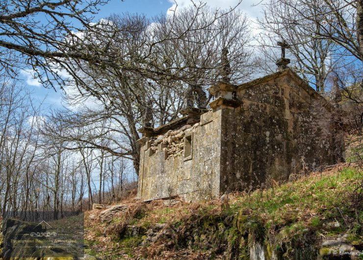
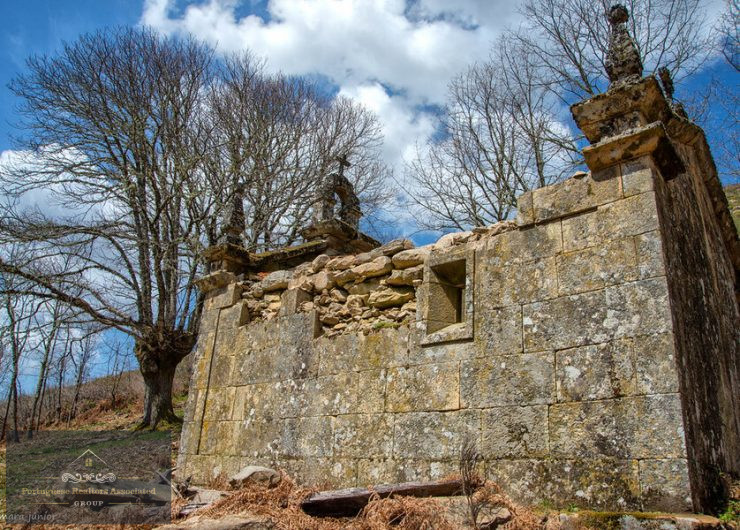
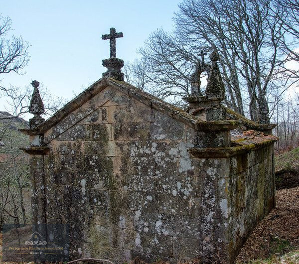
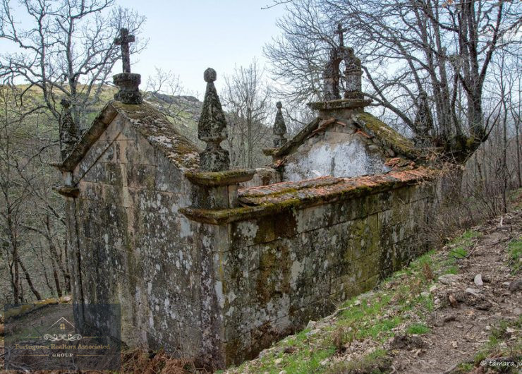
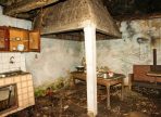
- Chapel and community threshing floor – Spaces of great cultural and social significance, perfect for community events and projects.
DEVELOPMENT POTENTIAL:
- Sustainable Tourism – Development of a rural tourism, ecotourism and agro-tourism complex, offering authentic experiences in full harmony with nature.
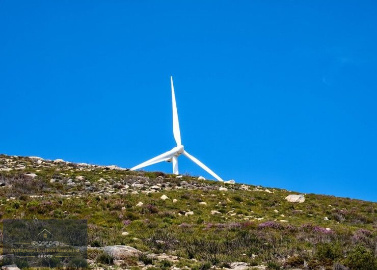
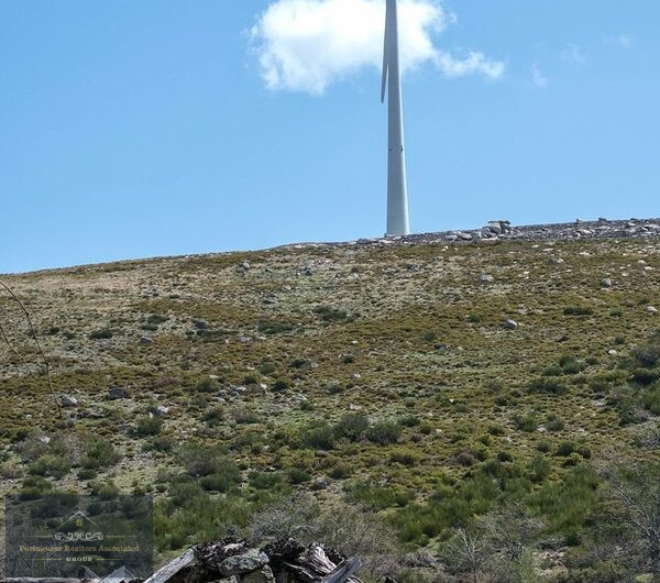
- Ecological Projects – Eco-friendly infrastructures, renewable energy, water sustainability and organic farming.
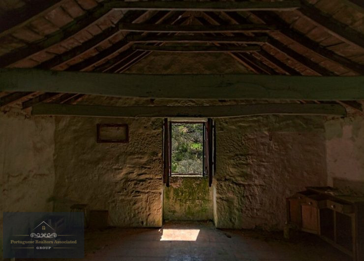
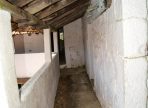
- Heritage Investment – Restoring historic buildings and creating an innovative rural renovation model.
If you’re looking for a distinctive project, with a high return potential and in line with global trends in sustainability and experiential tourism, Covelo do Monte is the right choice!
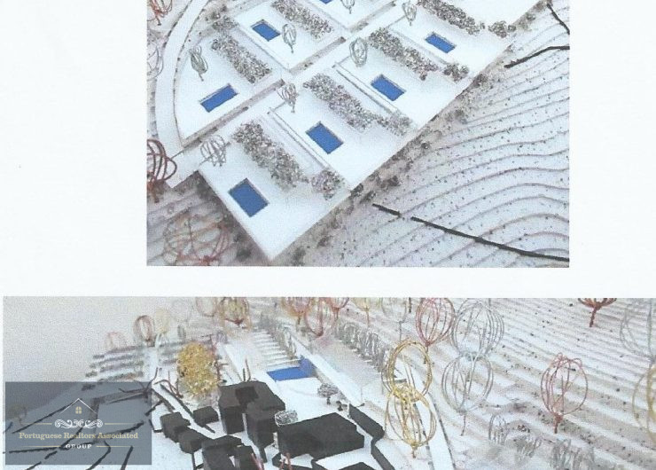
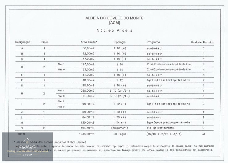
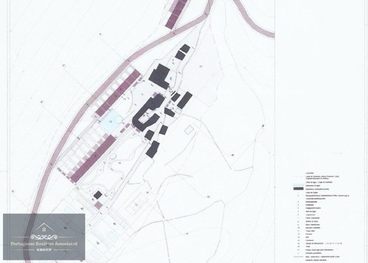
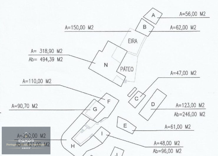
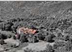
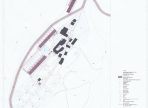
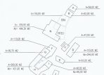
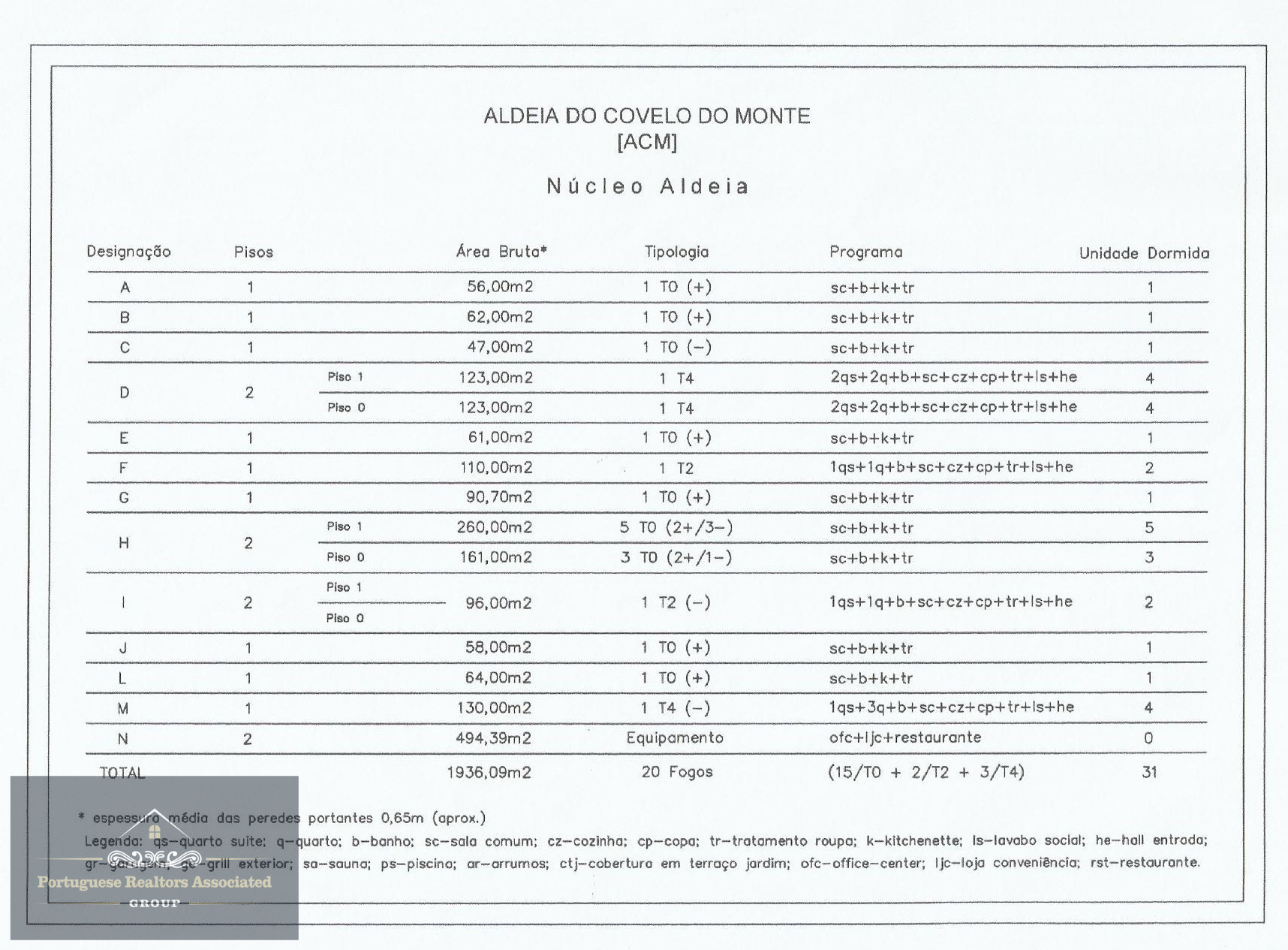
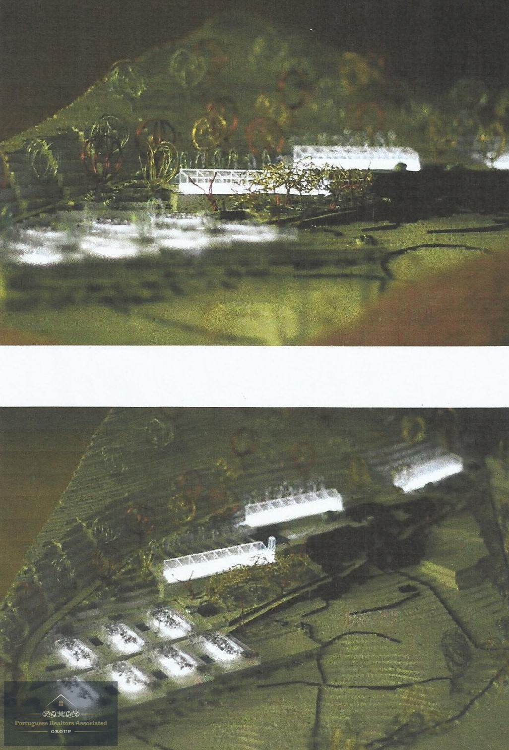
Covelo do Monte Village Plan
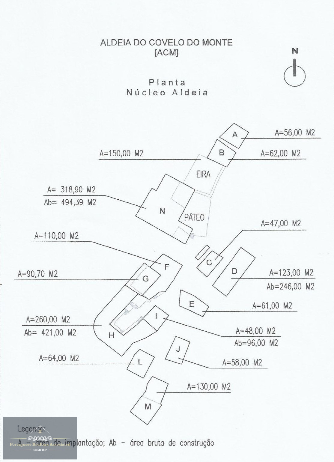
Description of the Village Plan
This diagram illustrates the layout of the village’s buildings and central spaces, highlighting key elements of the spatial organisation. The plan is orientated to the north, ensuring a better understanding of the location and distribution of the buildings and common spaces.
Highlights
Eira (threshing floor) and Pátio (courtyard): Constituted as essential community centres, these spaces are traditionally associated with agricultural, social and cultural activities and play a central role in the village’s dynamics.
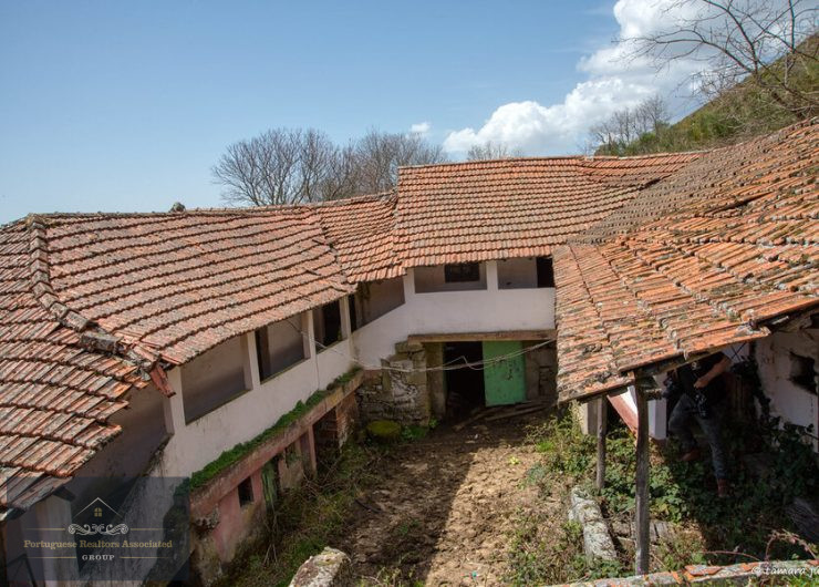
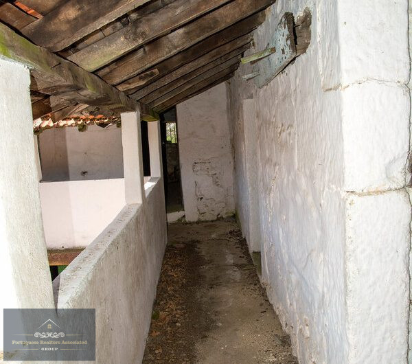
Diversity of Structures: The village includes a variety of buildings, including dwellings, support constructions and spaces potentially destined for tourist activities or services.
Identification of buildings: Each building is duly identified by a letter (A, B, C, etc.), accompanied by the following information:
A – Deployment area (m²)
Ab – Gross construction area (m²) (where applicable)
The size of the buildings varies significantly, from small constructions of around 47 m² to larger structures such as building ‘N’, with 318.90 m² of implantation area and 494.39 m² of gross construction area.
This plan gives a clear view of the spatial organisation of the village, making it easier to analyse the relationships between the different buildings and common spaces.
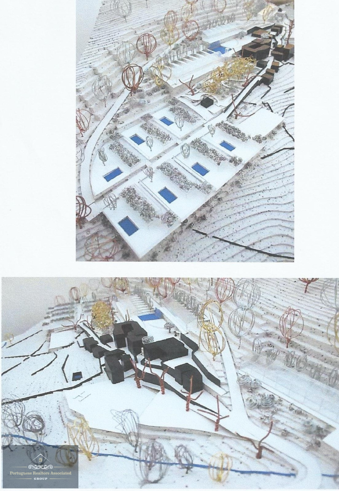
Synthesis Plant
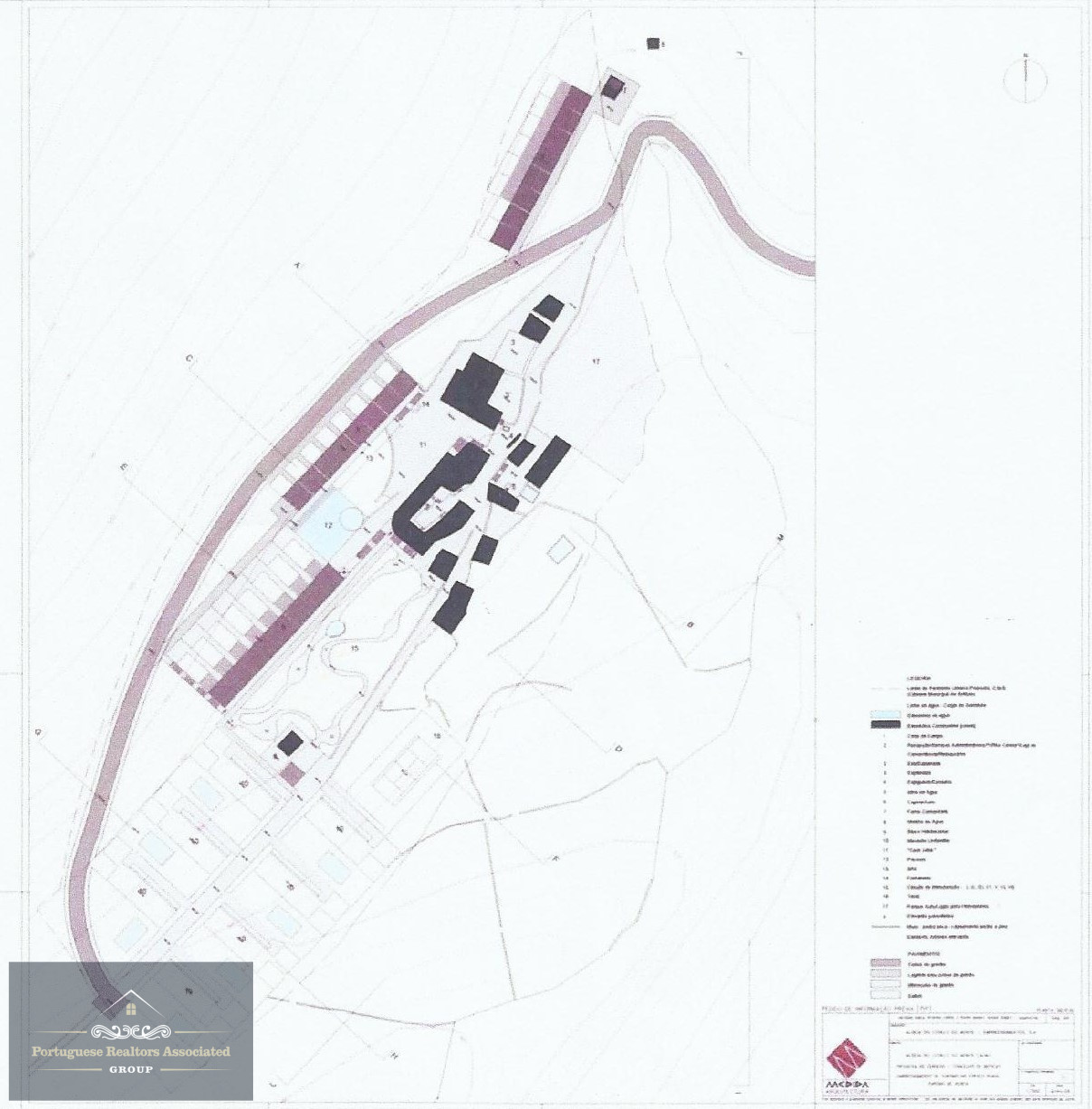
The map shows the general layout of the development, including the existing buildings and the new areas of intervention.
The main buildings are shown in black, while the new buildings or expansion areas are coloured in purple.
The drawing highlights the organisation of spaces, highlighting accommodation areas, community infrastructures and access roads.
Identifiable elements:
Village centre: Historic buildings and community spaces.
New accommodation and tourist infrastructure: Located along the main roads, presumably for accommodation and services.
Leisure and circulation areas: Internal paths, garden areas and communal spaces.
Access roads: Roads and routes linking the different areas of the development.
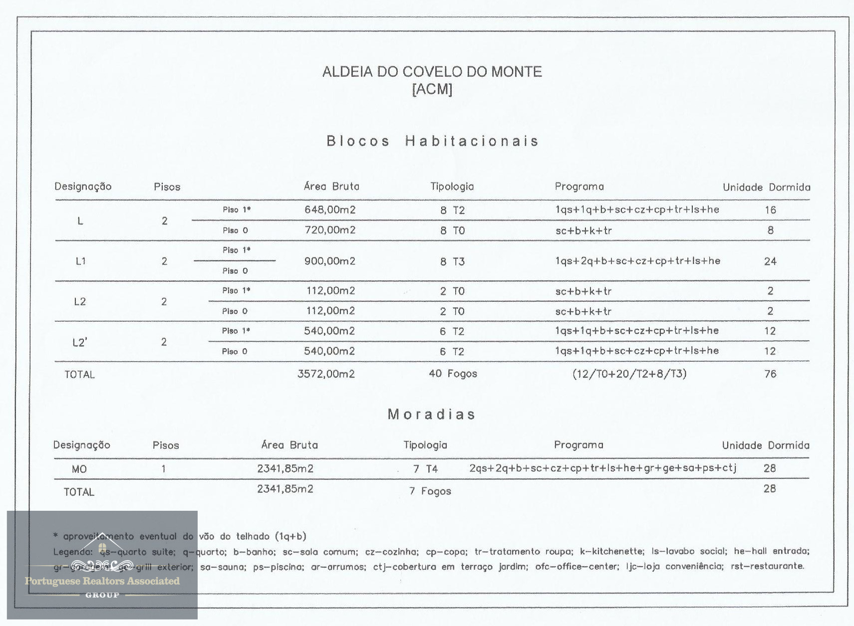
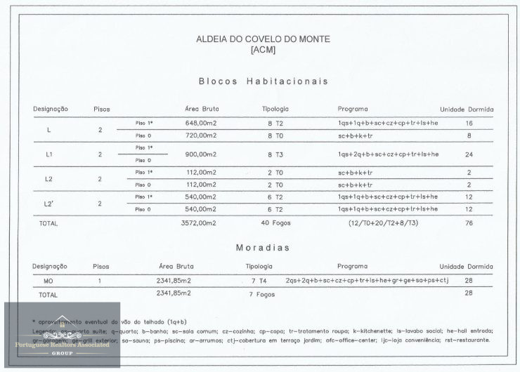
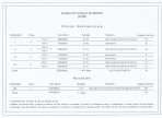
| Characterisation | Details |
|---|---|
| Enterprise | 47 dwellings (housing blocks and detached houses) |
| Total capacity | 104 people |
| Total Gross Floor Area | 5.913,85 m² |
Residential Blocks
| Parameters | Details |
|---|---|
| Number of Blocks | 5 (L, L1, L2, L2’) |
| Number of Fires | 40 |
| Floors | 2 |
| Total Gross Area | 3.572,00 m² |
| Typologies | T0: 12 units T2: 20 units T3: 8 units |
| Total Capacity |
76 beds |
Moradias Unifamiliares
| Parameters | Details |
|---|---|
| Number of Fires | 7 |
| Floors | 1 |
| Total Gross Area | 2.341,85 m² |
| Typologies | T4: 7 units |
| Total Capacity | 28 beds |
Technical considerations
- The development combines collective and individual housing.
- The housing units have optimised areas for different resident profiles.
- The project includes communal spaces and infrastructures to support residents.
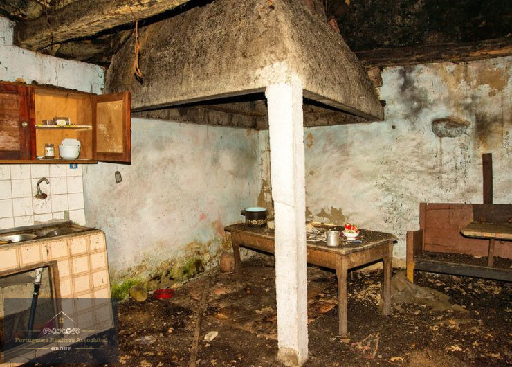
With tourism project approved (expired)
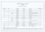
Technical Description of the Property
The Aldeia do Covelo do Monte property is made up of three distinct articles, totalling a significant area for housing, tourism and agricultural development. The distribution of the areas is as follows:
Total Area
- Article 1:073 m²
- Article 2:927 m²
- Article 3:784.30 m²
Total area: 661,784.30 m² (66.18 hectares)
- Constructed Area
- Covered area: 528.80 m²
- Uncovered Area: 255.50 m²
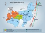
Location:
Coordenadas Geográficas:
Latitude/Longitude Decimal: 41.675933, -7.859151
Degrees, Minutes and Seconds format: 41°40’33.4’’N 7°51’32.9’’W
Accessibility and Infrastructures Nearby:
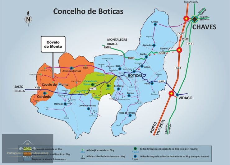
Montalegre (20 km) – Seat of the municipality, with essential services, shops and traditional cuisine.
Boticas (15 km) – Known for its rural tourism and the Carvalhelhos thermal baths.
Chaves (40 km) – Historic city with thermal baths, Roman heritage and connection to the A24 motorway.
Peneda-Gerês National Park (30 km) – Offers trails, waterfalls and observation of the local fauna and flora.
The village’s privileged location in a protected natural landscape with a strong cultural identity makes it ideal for ecological tourism, glamping, agro-tourism and sustainable development projects.
PRAG GROUP ®
“Deixe tudo connosco!”
- Referência: PRG025-AD
- Estado: Para Recuperar
- Objetivo: Venda
- Tipo de imóvel: Terrenos

A Certificação Energética classifica o desempenho energético de um imóvel numa escala de A+ (muito eficiente) a F (pouco eficiente) e recomenda medidas de melhoria a implementar ao nível do conforto térmico, destacando as de maior viabilidade económica.